Floods generally result from regional storm systems producing intense precipitation, from fast melting of winter snows, and occasionally from the failure of protective infrastructure such as dams and levees, often as a result of pressure from such events. We tend to think of the resulting flood damages as the inevitable consequences of these events, but they are not. Flood damages are the result of development decisions that place the built environment—and humans—in harm’s way. Most of those decisions, at least in the U.S., are made at the local level. In city halls and in planning commission and city council meetings across the nation, we have met the enemy of flood hazard reduction. It is usually us.
Tucked away from most public attention, the little decisions a community makes in approving new subdivisions are among those with the biggest influence in exacerbating or minimizing flood hazards to residential development. Cities, towns, and counties often assume that, if they simply comply with the fundamental requirements of the National Flood Insurance Program (NFIP), they are home free. But the Federal Emergency Management Agency (FEMA), which runs the program, while it can establish minimum requirements for local participation in the program, will never be in a position to substitute for local judgment on flood risk. There are too many important decisions that local government alone can make that FEMA cannot.
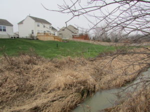
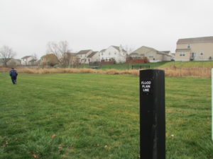
Less well understood by many is that there are significant practical limitations to the capabilities of the NFIP. NFIP regulations apply to mapped floodplains, but mapping floodplains for insurance rating purposes costs money, and that means higher priorities for mapping urbanized and developed areas where flood insurance will be sold. With more than 3.5 million miles of coast and river and stream frontage in the U.S., the NFIP has mapped about 1.2 million miles for Flood Insurance Rate Maps (FIRMs). Much of the rest is in rural and undeveloped areas, along smaller tributaries, such as streams and creeks, where development has yet to occur. Subdivision, of course, is a process of dividing and developing plots of land precisely where development has not yet happened. The possibility of a new subdivision proposal including land with unmapped floodplains is a constant reality. The stream corridors involved may seem small, but when flooding occurs they can often pose serious problems. Moreover, their floodplains may well expand as a result of the creation of new impervious surface in small watersheds—that is, hard surfaces such as building footprints, driveways, and roads. These impacts expand the floodplain because such hard surfaces do not absorb stormwater, unlike open space with trees and grass, thus increasing the volume of storm runoff.
To address these sorts of issues, the American Planning Association in 2014 FEMA to fund the production of a report for planners that has just been released: Subdivision Design and Flood Hazard Areas (Planning Advisory Service Report 584). It actually builds on prior work by APA two decades ago in a similar report, Subdivision Design in Flood Hazard Areas; both are being made available online as free PDF downloads and companion documents. The new report, however, goes far in bringing the subject forward and addressing contemporary realities, including the need to get ahead of climate change by anticipating potentially more extreme events and, in coastal areas, sea level rise. To amplify the outreach of the report, APA is scheduling its next Planning Information Exchange webinar in early December to address this topic.
The panel will include California attorney Tyler Berding, of the Walnut Creek law firm Berding & Weil, which has specialized in working with homeowner associations and developed an acute awareness of the problems raised when these associations inherit responsibilities for funding and maintaining flood protection infrastructure such as levees and small dams. As Berding notes, developers often sell local planners and elected officials on the idea that such arrangements, approved during plat reviews, free the municipality or county of the burden of such infrastructure. The problem arises many years later, when it becomes clear that these volunteer-managed organizations lack the expertise and also suffer from predictable downward pressure from property owners on maintenance fees, resulting in steadily deteriorating flood infrastructure that can result in disaster. Also on the panel will be Chad Berginnis, executive director of the Association of State Floodplain Managers and a major contributor to the report, for which I served as general editor, and Jerry Brems, now a retired planning director of Licking County, Ohio, who lent his experience in advising the project, who has dealt with these issues. I will moderate.
The overall point of the report is to highlight the fact that there is typically much more a local government can do to exercise vigilance in this respect than typically happens. The report outlines a number of standards communities can adopt with regard to the protection of natural and man-made features on a subdivision site, the layout and design of the site, its infrastructure, platting requirements, and watershed management. It also discusses how all this can be integrated effectively into the larger planning process of the jurisdiction. For instance, it discusses and provides a case study on the use of conservation subdivision design, which allows the clustering of structures on a site to locate them on higher, safer ground while maintaining more vulnerable, low-lying sections in common open space, which in turn allows the creation of such amenities as riverside walking paths, habitat protection for wildlife, and preservation of forested buffer areas along stream corridors. These and many other steps help reduce flood losses while creating a more resilient, safer, and environmentally sustainable community.
In short, the entire project invites communities to explore ways to become more forward-looking and creative in their approaches to flood hazards. The world is improved more often incrementally than radically. We hope we’ve brought planners’ and public officials’ attention to one more such increment.
Jim Schwab


